We started a little late as we had a “light” day in our plans. After finally making it to the Madison Junction, 14 miles and about an hour due to bison on the roadway, we turned north to Norris then, taking a new route, turned east towards Canyon Village. We immediately made our first, unplanned detour, taking the Virginia Cascade loop.
This is the cascade on the Gibbons River. The canyon was about 500 feet deep, almost straight down from the roadside, with no guard rails. Luckily, it was a one way road and very little traveled.

Once we passed Mt. Washburn, our original choice for our day hike, we continued on, through Tower-Roosevelt and on to Mammoth Hot Springs. The parking area at Mt. Washburn was closed and there were both a tracked snowplow and a large, rotary snowplow attempting to clear the heavy snow away in the parking lots. The trail, partially visible from the roadway, was completely covered in snowpack. Climbing would be near impossible without crampons.
We stopped near Tower Falls to take a quick look at the north end of the “Grand Canyon of the Yellowstone”. We are planning on visiting the canyon in its entirety tomorrow.

You can clearly see the layer of magma near the top of the canyon walls. This is the result of an earlier (50 million years ago) eruption and the soil on top is a result of subsequent years of erosion. There were supposedly bighorn sheep at the base of these cliffs but we did not see any.

We could not pass the Petrified Tree. This is the remains of a redwood tree, evidence of a warmer, damper time. This trunk is anatomically indistinguishable from present day redwoods found in California. When a chain of massive volcanos erupted here in Eocene times 50 million years ago, they triggered massive landslides into mountain and valley streams. The rolling mix of ash, water and sand buried whole forests. Before the trees could rot, abundant silica in the volcanic flow plugged living cells, creating “forests of stone”. A photo of this tree, taken in 1907 shows additional petrified trees in the background which are no longer there. This tree remains only because it has a substantial fence surrounding it.

We were hampered crossing the bridge over the Gardner River into Mammoth because this guy decided to take the bridge route to cross the river. For some reason, Yellowstone Bison just have to walk right on the yellow line in the center of the road! For this guy, it was a good choice as the river is hundreds of feet below the bridge! This photo is a real “Truth in Advertising” plug. Note the road sign behind the Bison: “Caution – Wildlife on Roadway”.

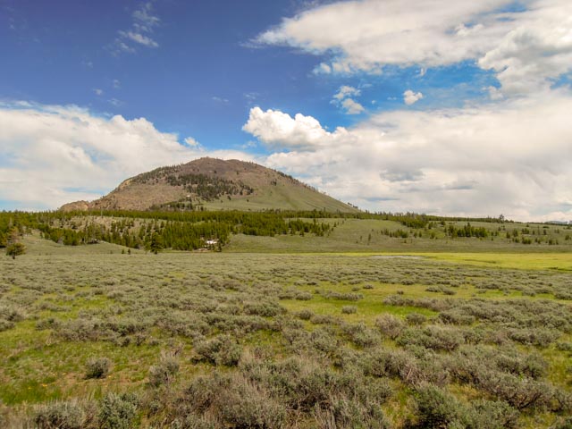
Our secondary climb destination choice was Bunsen Peak. This photo was taken from our (down the) roadside parking. Because we were arriving in early afternoon, there was no parking available as the lot was servicing several trailheads. It was intimidating that there were four Forest Service Ranger trucks parked here, probably bear related (keeping the people away from the bears).
As we started our climb to the top we passed this sign. Cathy and Jason are making the uphill turn.

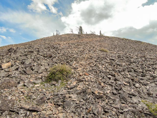
Jason loved climbing through the loose rock and fallen trees. We were mostly on the south side of the mountain as the northern face was covered in deep snow. The last half mile to the top was basically a scramble as the trail was snowed under.
Here is the view near the top. We still had a good deal of loose rock and heavy winds to cope with to complete the ascent. Jason did not want to quit and was determined to beat me to the summit.
We made it! Jason, being the first to summit signed the visitor logbook.
We took a few minutes to savor the accomplishment and the views before starting the descent. We had panoramic views of the Blacktail Plateau, Swan Lake Flat, the Gallatin Mountain Range, the Yellowstone River Valley and we could almost see our truck! This was a five-mile “Walk in the Woods”.
From the top, we could identify several “shortcuts” that had been blazed due to the snow on the north slope. The wind altered the shape of his hat, making him a “Pirate” momentarily.
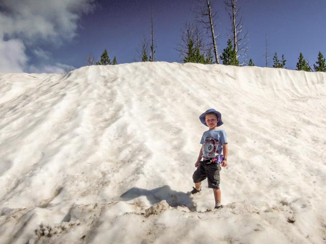
We bypassed several of the snow hazards that we traversed on the way up, but could not avoid this 10’+ deep area. We did have the expected snowball fight…but Jason started it!
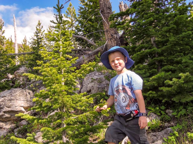
Pausing for a moment at a pint-sized Christmas tree. It is too early in the year to put in the overhead, though.
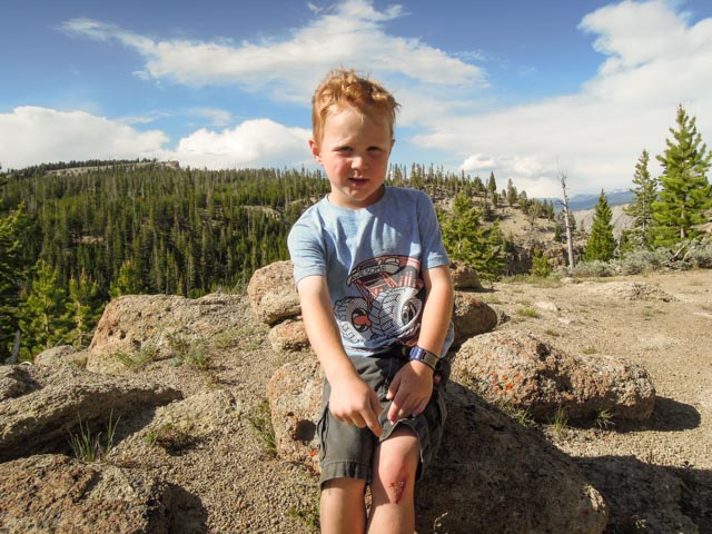
Jason zigged when he should have zagged and stumbled over a rock. His knee hurt but he was walking it off until he saw the blood. Then it REALLY hurt. Overall, he was pretty proud of his accomplishment, especially the injury.
Back in the valley with Jason celebrating the climb with his “Strongman” pose.

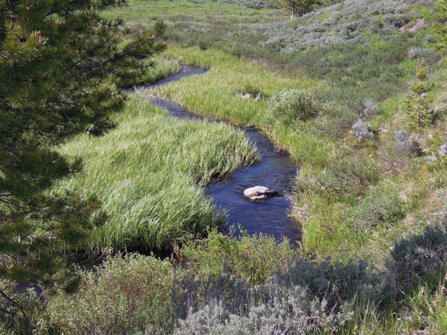
Below is one of the myriad of streams that we saw and/or crossed on the trail.
Heading back to camp, after another half hour delay due to the road repairs/construction between Mammoth and Norris, we watched the sky began to really darken. I told Cathy that I would like to find a place with a meadow to photograph. Voila, we came upon this scene almost immediately. The sun was shining overhead, the sky was turning almost a purple-blue in the distance and this big guy just happened to walk into the scene.

Nearing the homeward bound turn at Madison, the road again came to a complete stop. After being immobile for about 15 minutes, a park ranger with lights ablaze passed us in the roadway parking lot and was up ahead, persuading the bison to get off the roadway. It cleared up somewhat but one bison decided to open shop in the middle of the road and was serving a customer as we passed.

We saw elk, bison, bear, deer and a bald eagle today. We did make it back to camp early, 8:30 or so.
