WEDNESDAY
On our first full day in Page, we went to lunch at a restaurant that we were told served Navajo tacos. They didn’t. After lunch we made the short drive to the Glen Canyon National Recreation Area and spent time in the visitor center. This center had an extensive exhibit about the (Glen Canyon) dam, from planing through construction. It is amazing that this dam is on par with Grand Coulee (WA) and Hoover (NV & AZ) in physical size and water storage.

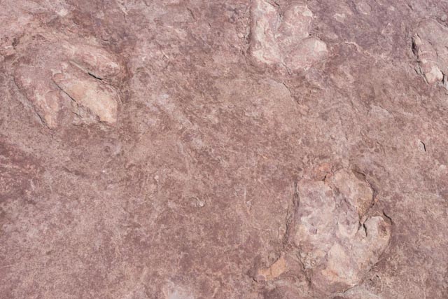
These imprints were found in a nearby side canyon. They are from a Dilophosaurus and the tracks are in silt, as evidently the area was a marsh 170 million years ago. They were destined to be submerged as the lake rose behind the dam so this slab was saved.
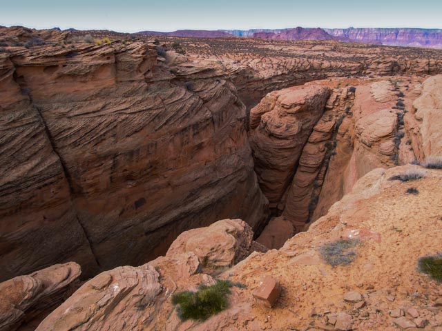
Next, we went back to a small canyon that we saw when approaching Page the previous day. It is called Waterhole Canyon and is on Navajo land, so you must obtain a permit from the Tribal offices to enter. This canyon is right on the highway and very, very deep. The photos do not truly represent the depth or the colors of this semi-slot canyon as they were taken in cloudy conditions.
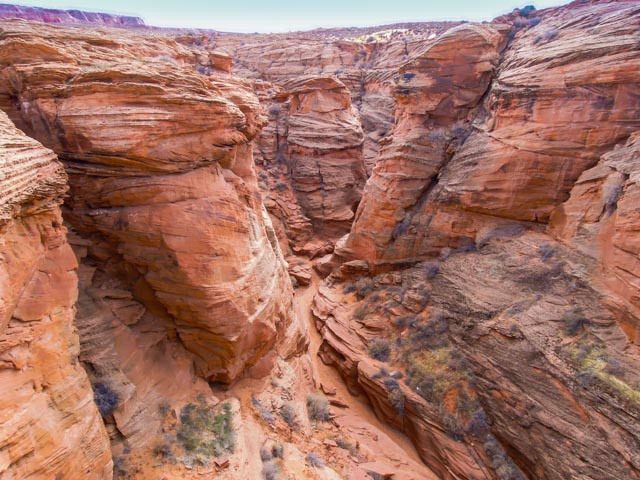
In the late afternoon we made the drive to the Antelope Canyon area to gather information for a future trip. Antelope Canyon is a series of slot canyons, all located within the Lake Powell Navajo Tribal Park. Entrance to the slot canyons requires a Navajo guide. I spent some time talking with a Navajo photographer to determine the best time of the year and the best canyon (with wall striations being my preference) and she indicated mid-May as the best time for direct sunlight and the best canyon for striations was a canyon called Rattlesnake. I will be trying to fit this into a future planned trip to the area as these canyons are breathtaking. We did look down into one three-foot wide and fifty+ feet deep canyon and Cathy decided that she will not be going down into these with me.
THURSDAY
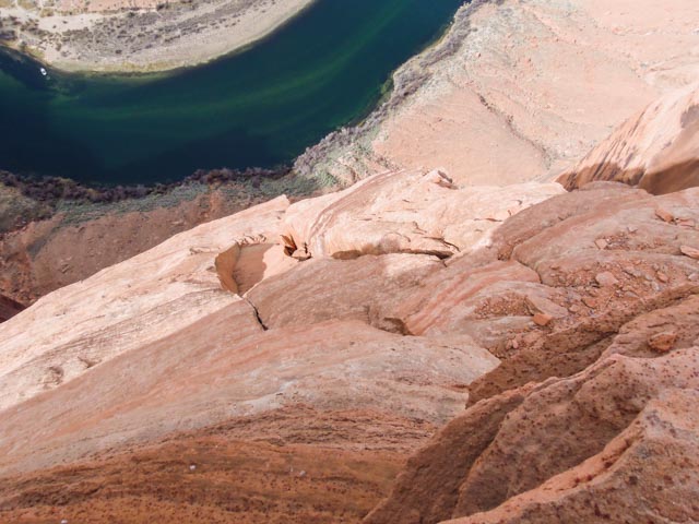
The next morning, the sun was (almost) out so we made the trip to Horseshoe Bend, on the Colorado River. There were several small boats with trout fisherman below, but they are hard to spot.


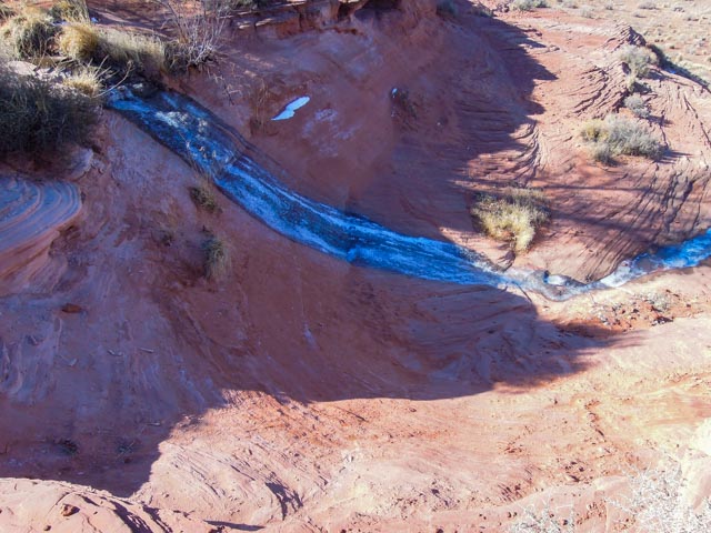
I laid down and hung out over the edge to get some photos, including this one looking straight down.
Cathy did not want to hang over the edge but she did get close . . . kinda.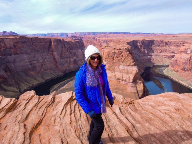
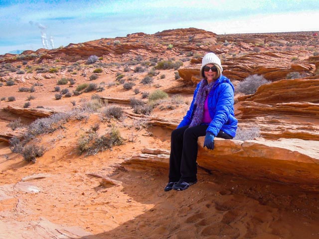
She did find a comfortable seat to people watch on the way back to the car. It was about a half-mile trek from the trailhead to the edge of the canyon.
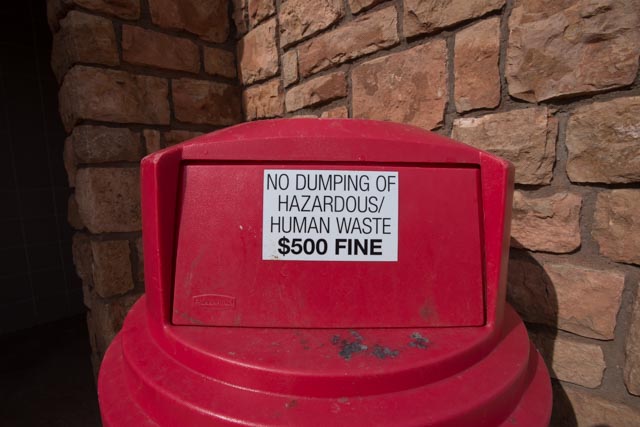
We found these notices in the outhouses. It makes you wonder what has happened to make this signage necessary.
FRIDAY
We had to pick up my race bib in the afternoon, so we decided to make a drive in the morning to the Vermillion Cliffs National Monument, south of town. The clouds were just lifting when we made the turn north at Bitter Springs.


This is the Navajo Bridge as seen from the Navajo Bridge Interpretive Center. We picked up a couple of books at the center and a surprise for Jason.
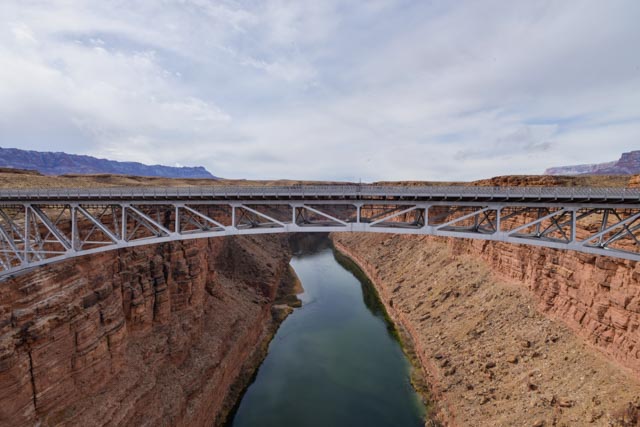
The Colorado river below the bridge. 
I have to add this, located at the Interpretive Center, to my growing collection of too much information . . .
We continued to Marble Canyon and saw some of these “Floating Rocks”.
This is Cathedral Rock, as seen from Cathedral Gulch on the drive to Lee’s Ferry.

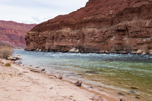
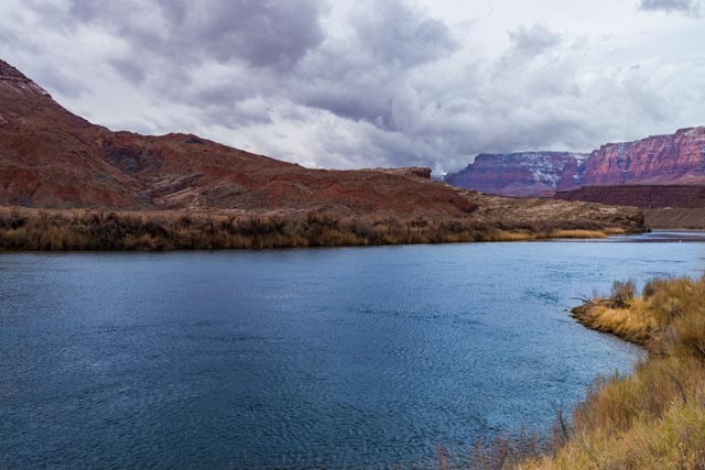
Tis is the Paria Riffle on the Colorado River at the point the Paria River joins the Colorado.
We visited the Lees Ferry site, located at the end of the canyon. The buildings below were the Corporate Headquarters (?) of the American Placer Corporation and the second building in the back is the Lees Ferry Fort. We purchased a book about Mr. Lee. He was not a very good guy and not mentioned much at this site other than it used his name. Something about a massacre?

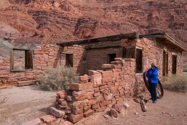
The one-story, stone building was constructed in the summer of 1874 by the Mormon Church to serve as a combination trading store and fortification for dealings with the Navajo Indians across the Colorado to the south. Notice the two gunports on the back of the building. This “fort” was never used.

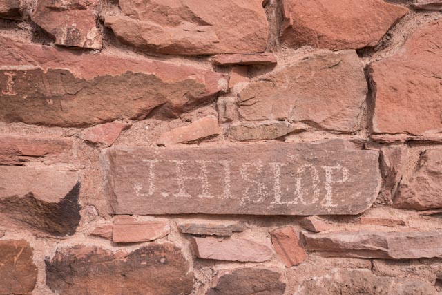
There was no information concerning this inscription on site so I researched through the University of Northern Arizona and found the following:
- This glyph dates to an 1891 prospecting-river trip initiated by Denver capitalist James S. Best. The plan was to descend the Green and Colorado Rivers from the railroad town of Greenriver, Utah to a silver vein located in the depths of the Grand Canyon below Lees Ferry. Best was called back to Denver to meet with the mining company and four of his team spent the better part of two months at this location. J. Hilsap took it upon himself to carve his name to the right of the eastern front door.
If this was recent, it would have been graffiti, but because it dates more than 50 years, it is refereed to as historical, thus it is a “glyph”.
We found this a little bit up the canyon, being unmarked, we believe it to be what’s left of the Jerry Johnson Cabin.

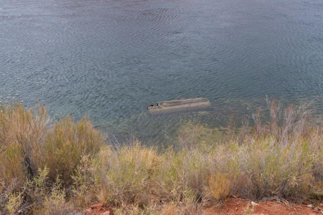
We hiked a short trail to the Upper Ferry site and on the return came across this submerged remnant of the Charles H. Spencer Paddlewheel Steamboat. This boat was hauled in from San Francisco in pieces and assembled on site. She only made one crossing. Being designed for the relatively placid Sacramento river, she proved to be unsuited for the swift currents of the Colorado. She rotted at the dock and finally submerged in the early 1920s.
The river is clear and cold as it emerges from the bottom of Lake Powell. We saw several trout fisherman in waders casting flies downstream.
Across the river we saw this snow bank. It looked out-of-place in the desert but indicates how cold it was here.

This is one of the Spencer boilers. In an attempt to retrieve gold at Lees Ferry, Charles Spencer set up a Lovett Pipe dredge on the opposite side of the river. He put wheels on this steel boiler and hauled it from the railroad at Flagstaff with a team of Oxen in 1910. There is the remnants of a second boiler a short distance away. That is me, trying to push it over . . not really.

Since we were hiking in desert, we had to watch out for the cactus with very long spines.
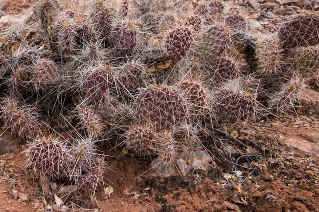
And these cactus with very short spines . . .

On our way back to Page, we saw the storm let loose at the Vermillion Cliffs area we had just visited. We ran into the related snowstorm in the Echo Cliffs area but it lessened somewhat as we descended into Page.

I received this notice from the race director just prior to the race. Here kitty, kitty. . .

SATURDAY
At bib pickup, we met Tomas, to Cathy’s right. He performed a traditional Navajo Hoop dance for the runners. Tomas is ranked in the top 10, worldwide in Native Hoop dancing. With Tomas were two other Navajo who provided the chants and music.

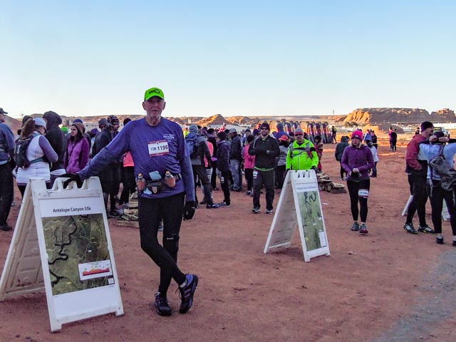
Race morning, sub-freezing and ready to go. the sun has just come up and most of the runners are grouped around bonfires.
Cathy using sunlight to keep relatively warm. She will wait for me in the motor home where conditions are more inviting. The bonfires are behind here. This area is called the “Amphitheater” for good reason
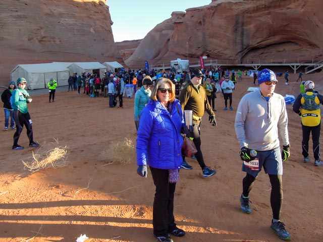
A mile into the race and we are still bunched up.

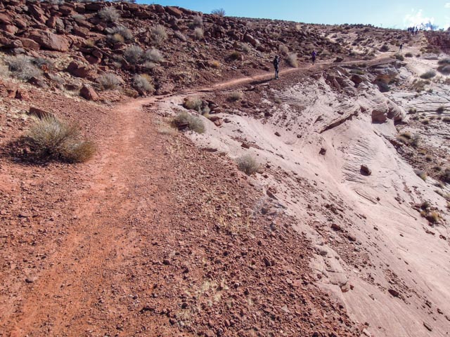
These three photos show our climb onto the mesa, from a distance, then from the climb itself and finally looking back at it. It was far steeper than it looks.
There was plenty of single-track cliff side running on the trail. the views were spectacular.


Lake Powell as seen from the trail.

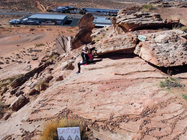
Our first aid station. It was located up a very steep and sandy canyon, about .2 miles off the trail. This was a required “out and back” as timing devices were located there, between the fence sections. I did see several people balk at the climb.

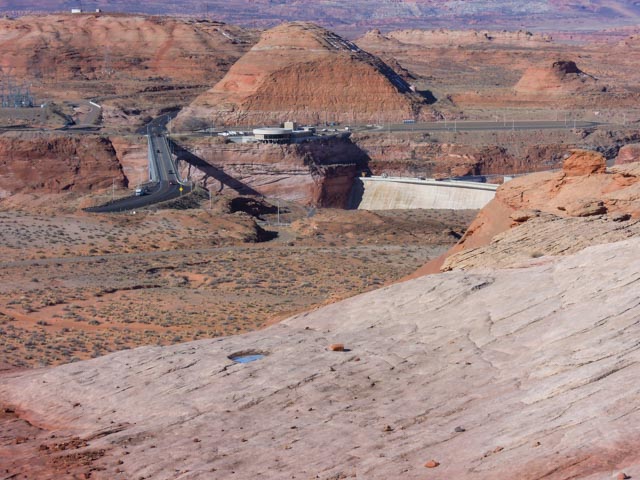
Glen Canyon dam and visitor center as seen from the trail on the mesa.
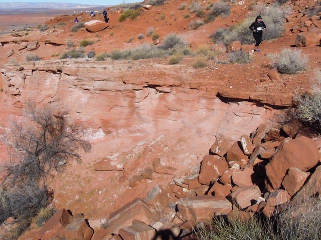
More single track with sharp drop-offs cliff side.
We passed this pretty cool (literally) stream eight miles into the run. It was frozen solid and may have made a good slide?
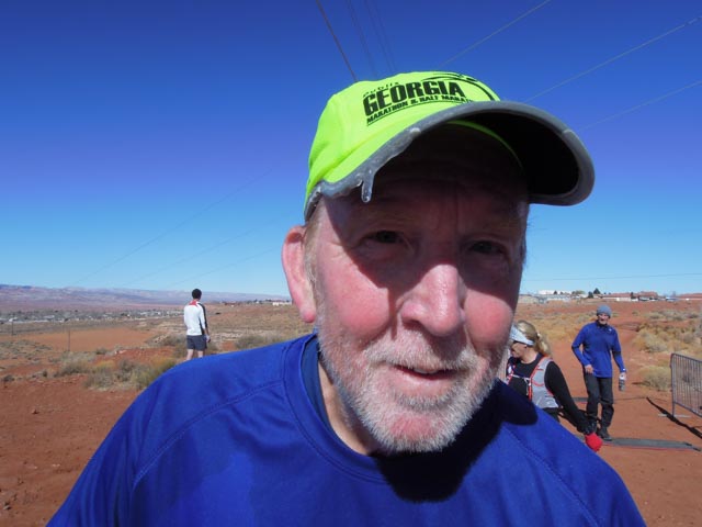
I guess it was cold, this is my hat at the second aid station. Our motor home is in the valley over my right shoulder.
A mile to go and the trail disappears? NO, you have to climb down the face of this cliff. No wonder why I could not locate this trail on my practice run the day before! I would not have expected this so late into the run.
Once you scrambled over the cliff, the finish was in sight . . almost. There was still a quarter mile of deep, soft sand to run trough. The finish line is located behind the campers, around a hill and out of sight.

After crossing he sand, then some “ripple rock”, we went through the last canyon on this fabricated walkway.

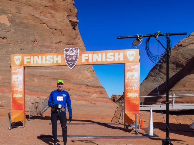
The walkway ended at the finish line. I am holding my finisher’s cup. I placed third in my division. And I got a tin cup. Pretty cool.