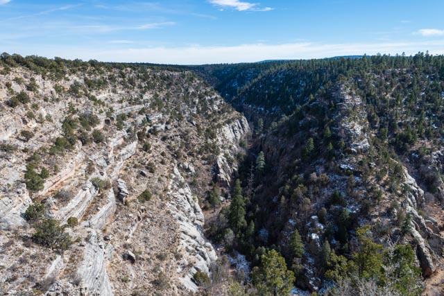
We took a breather and drove a “short day”, from Grants, NM to Kingman, NV. On the way, we took a side trip to the Walnut Canyon National Monument, just east of Flagstaff. This very deep canyon was loaded with cliff dwellings and pueblos built by the Sinagua Indians and abandoned about 800 years ago. These are the same group that built the cliff dwellings in the Sedona area.

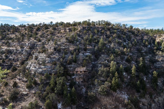
Several of the pueblos are visible in the rocks, directly across the valley from where we were standing:
It was a steep climb down to the floor and back up the side of the very deep canyon, but the trails were well designed, following the contours of the rock ledges. They were used by the original inhabitants for centuries and rebuilt or repaired by the CCC in the mid 1930’s.

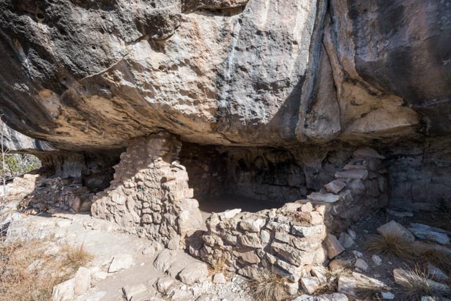
The dwellings are in remarkable shape, especially the ones that are harder to reach. Unfortunately, in the late 19th and early 20th century, it was a popular site for tourists to vacation, picking and digging for ancient relics, but their destruction was stopped by local residents fairly quickly, minimizing the damage to this significant structure. We climbed down a cliff side path/trail that led to some of the best preserved units. You can even see where the cooking fires were as the soot remains on the back walls.

This is another photo of the terrain that we were experiencing. Note the sheer walls and the snow present in the shaded areas! It was amazing that these pueblos were built by hand, with each stone quarried, and mortar mixed and water carried up these cliffs.

Cathy deciding if this would make a good summer home?

We decided it would take too much renovation . .
Other examples of pueblos we saw as we continued on the trail:
After spending the night in Kingman, we drove near Hoover Dam, through Las Vegas and are now in Amargosa Valley, next to the NV/CA border. We decided to take the truck into Death Valley but oops, we forgot to put gas in it! We drove back to the interstate, about 40 miles (rt) to find a functioning gas station. This particular gas station also had a brothel attached! One stop shopping?
After fueling the truck, we took a side trip (gotta love those side trips!) on the way back to camp, driving down a dirt and gravel road into the Ash Meadows National Wildlife Refuge. We walked a trail, following a crystal clear, free-flowing stream to its source, the Crystal Spring. This spring flows at 2,800 cubic feet/min and the water is a warm 87 degrees.
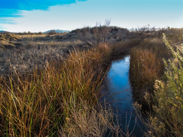

The spring is about 15 feet deep, crystal clear and contains the endangered Ash Meadows Amargosa pupfish. The total habitat for these pupfish is less than one square mile. We felt lucky to see several of these swimming in this stream and several larger ones in the pool at the spring:

This picture of this spring does not do justice to the clear waters and the deep blue coloration, found in the middle of the desert, a mile from Death Valley! We plan on returning in the morning to get a better look at this in daylight.
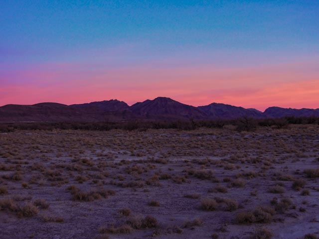
Even though it was getting dark fast, we did make it to the Crystal Reservoir and took a couple of pictures of the sunset. The mountains in the background are in Death Valley, CA.

These are the mountains behind us (in Nevada), almost alpenglow, but I am not sure if that term can be used on desert mountains:
Tomorrow we are returning to see to Point of Rocks, home of the Chuckwalla lizards, the Longstreet spring and cabin and Devils Hole (in a far corner of Death Valley). A good day of hiking and relaxing before moving on to Furnace Creek and the race.
