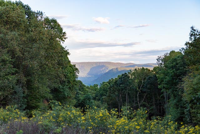
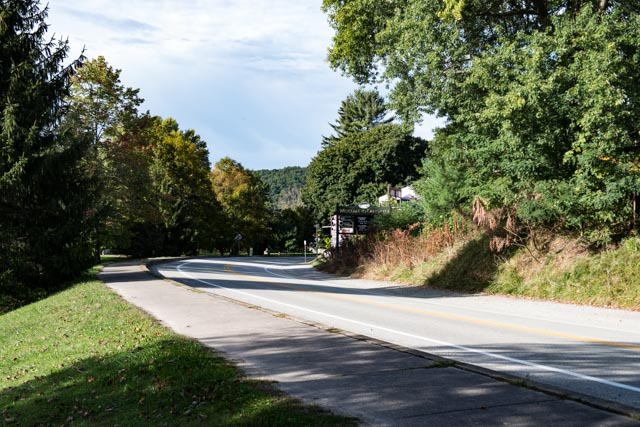
After leaving the state of Michigan, we travelled through Illinois, Ohio, West Virginia and into Pennsylvania to visit the Laurel Highlands area of Western Pennsylvania. We travelled some pretty narrow roads into our destination of the Kentuck Campground located within the Ohiopyle State Park. This is a view of the highlands, looking across the gorge created by the Youghiogheny River from our campground in the late afternoon:
The reason for making the trek to this area was primarily to see Falling Water, and we have arrived:

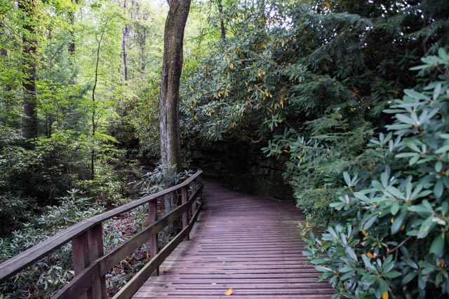
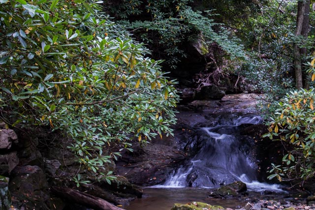
We obtained a hiking/trail map of the area and proceeded down the well-marked trail into the rhododendrons and rushing streams:
And here it was, in the middle of the forest, the iconic home designed by Frank Lloyd Wright in the 1930’s! It is hard to imagine that this home was designed and built almost 100 years ago. And the engineers said it could hold up!
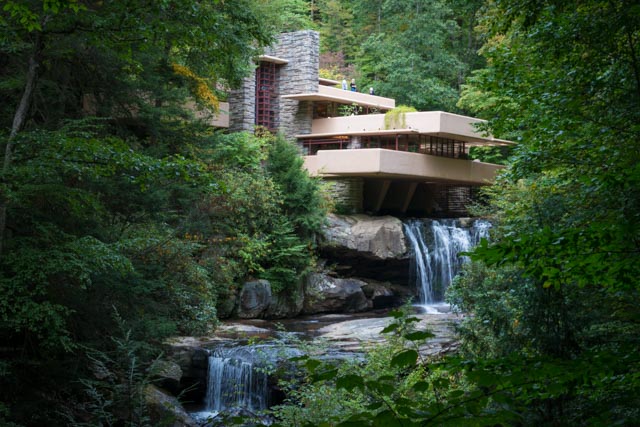
Some more shots of this awe-inspiring home:
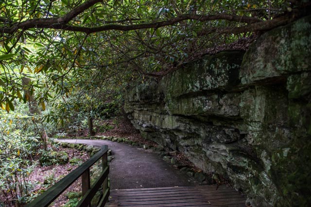
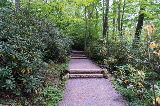
The loop trail leading back to the visiter center and parking lot. Due to the season, there were very few people here.
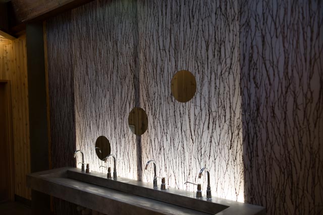
This, believe it or not, it the sink in the public restroom. It was beautiful, totally out-of-place in a restroom, but the whole facility was over-the-top in design and cleanliness.
After visiting Falling Water, we thought that would be it for the area, but we found more to do. We went into the “city” of Ohiopyle and found that it was a hub for white water rafters/kayaks, and bicycling. There were many bike trails nearby, including a rails-to-trail Great Allegheny Passage, extending 27 miles to connect Pittsburg to Cumberland. There were also more than 25 miles of mountain bike trails, almost 12 miles of horseback riding trails, trophy trout fishing in the river, and class III and IV whitewater boating. It was past the end of the season but there was still some activity.
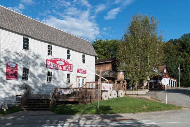
The river flowed through town
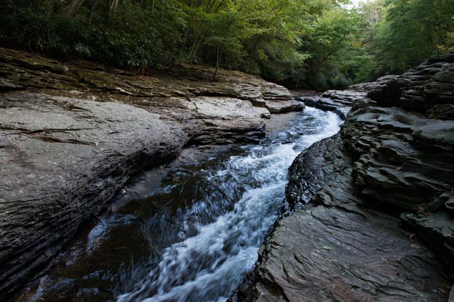
Upriver, on a feeder creek, we found this hundred foot long natural slide area. It apparently is well-known and relatively safe.
I had to get a higher look at the slide. Trying to get the courage to give it a shot.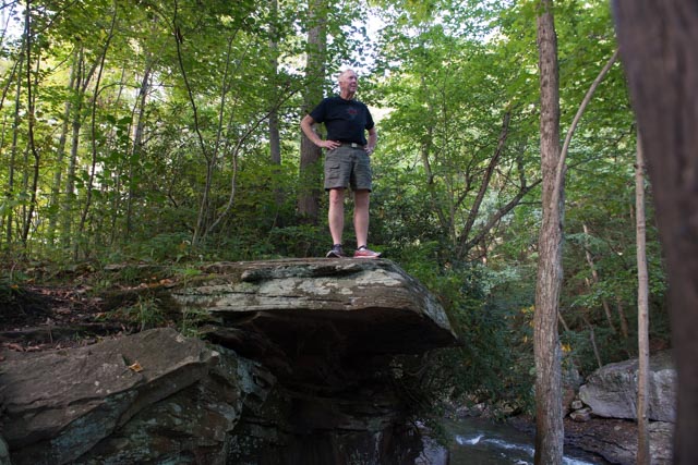
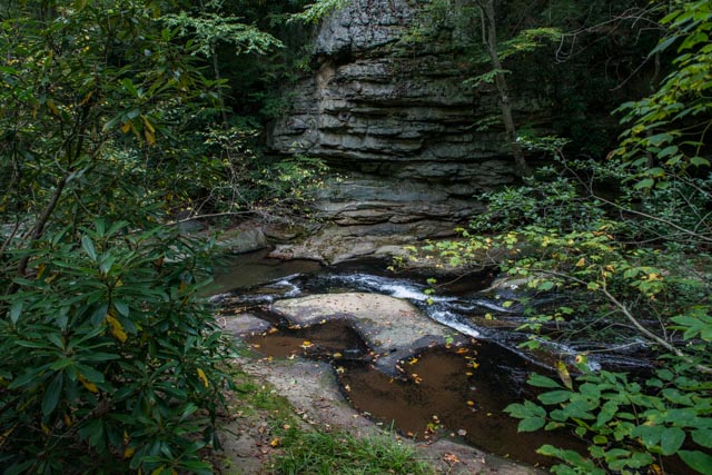
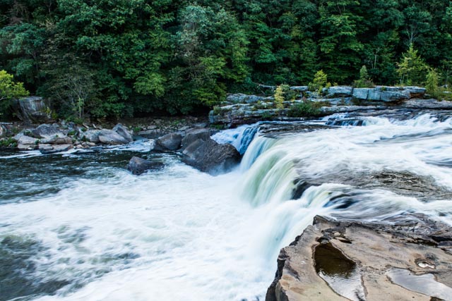
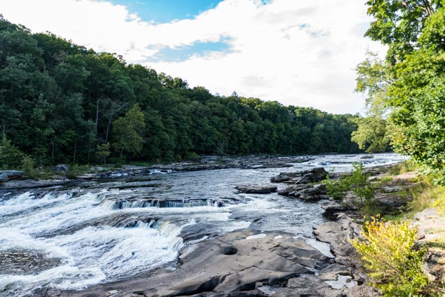
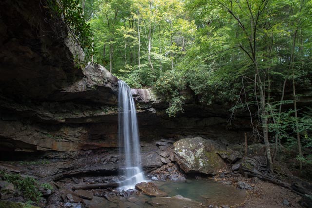
We spotted a trail head leading to Cucumber Falls and made the hike down the canyon the next morning to be rewarded with this view:
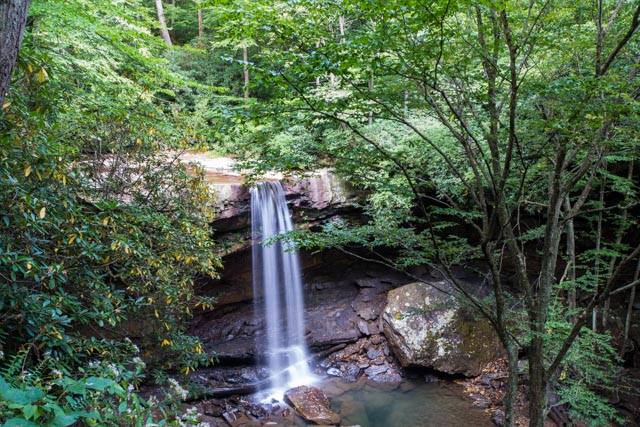
We continued past the falls and followed the trail to its end, on the Youghiogheny River: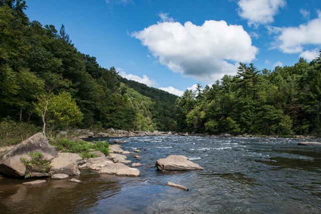
In the afternoon, we went to the Fort Necessity National Battlefield. Fort Necessity National Battlefield is a National Battlefield Site which preserves the site of the Battle of Fort Necessity. The battle, which took place on July 3, 1754, was an early battle of the French and Indian War, and resulted in the surrender of British colonial forces under Colonel George Washington, to the French and Indians, under Louis Coulon de Villiers. Washington was allowed to withdraw his troops without penalty. This was a very early battle in the French and Indian War.
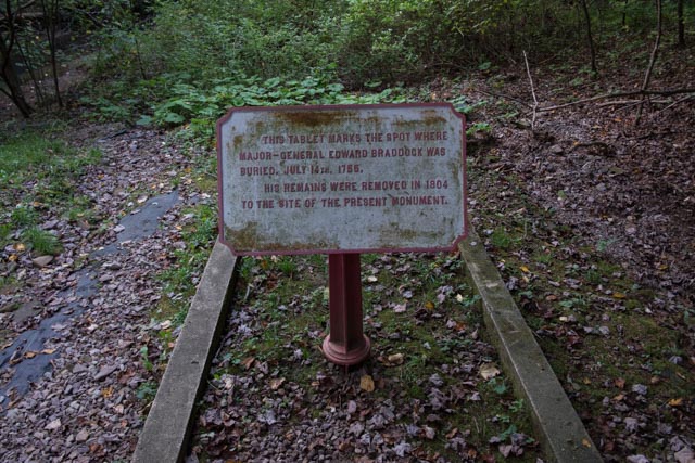
A year later, Major General Edward Braddock, Commander-in-Chief of the British forces in North America marched through this spot with a force of 1400 men with the intent to expel the French forces from Fort Duquesne and the Upper Ohio Valley. On July 12, 1755, they were overrun by 200 French troops and 600 Indian fighters, resulting in more than 900 British casualties and mortally wounding General Braddock.
Braddock died at this site the next day and aide-de-camp George Washington officiated at the funeral. He actually was buried in the middle of a narrow road and the original, unmarked grave was discovered in 1804 by roadway workmen. The grave was unmarked to prevent it from being vandalized by Indians. The remains were then reinterred to this spot and the monument was erected in 1913.
 Upon reading that, we searched the area for the narrow path/roadway and walked down the hill, through the poison ivy/oak to find the original gravesite:
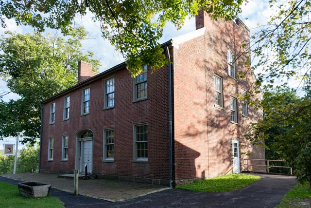
This is Mt. Washington Tavern, constructed in 1830 and located on the National Road. George Washington proposed this route in the late 1700’s and Congress authorized its construction in 1806. Actual construction started in 1811 and it eventually stretched more than 600 miles, before being replaced by railroads. The Tavern was one of many built to service the customers of the stages along their journey. This particular stop was one of the finer taverns, built primarily for the Good Intent Stage Line.


Nice pics and an interesting trip!
LikeLike