We have been travelling with eight foot high fencing alongside the Trans-Canada Highway for a couple of days and have seen these fixtures every 1k or so along the route. I had to stop and see what they were. They are one-way gates, to allow human passage but prevent larger animals (moose) from getting onto the highways. Pretty effective as we saw no evidence of moose/deer/caribou flattened on the highway.

After spending the night in Campbelton, we stopped at the Battle of the Restigouche National Historic Site in Pointe-a-la-Croix on the Gaspe Peninsula. This was the last time that France and England fought each other for possession of the North American territory. The French were superior on land, the English were masters of the sea. Unfortunately for the French, this battle was between warships. The British ships carried up to 70 cannon while the largest French ship, the Le Machault, carried only 26.
The battle 1760 was over quickly, with all five of the French flotilla sunk. The Machault was sunk in the river, to the left of the hill in the background. It remained underwater until forty-five years ago.

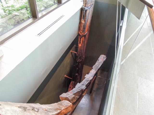
This is the keel of the Machault, brought up from riverbed in an excavation that lasted from 1969 to 1972. The piece is made of european oak and is in remarkable shape considering its time underwater. The size was considerable, as it continues below floor level into a “basement”. Across from it is the rudder from the ship, which can be seen as the vertical piece in the second photo.

Oriental porcelain and French earthenware, salvaged from the ship…

Copper and brass pots and utensils did not fare so well..

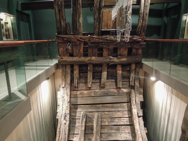
This is a full, cross-section of the ship, housed in its own room due to its size. The cannon suspended from the ceiling indicates where it would have been during the battle. The exterior “flap” covering the cannon hole is still there.

Below are articles of clothing found during the excavation. There were also cases of glass, silverware, guns, cannons, mortars, and other artifacts displayed in many cases throughout the museum. Everything on display came from this one ship. The other four ships are still at the bottom of the river and there are no plans to excavate them.

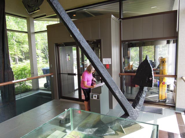
Cathy is adding comments to a visiter comment book. The original ship’s anchor was immense in size.
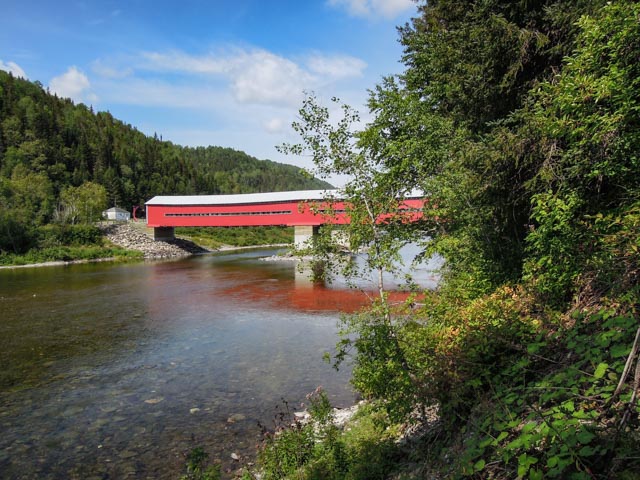
After leaving the Battle site, we continued up Highway 132 through a gorgeous canyon and saw several of these covered bridges spanning the river.
We know we are in Quebec, all signage is in French, and most of the streets, highways, towns, etc. are described using multiple words. The GPS is going nuts trying to pronounce the streets/roads/highways.
We are staying in Levis, directly across the Fleuve Saint-Laurent from Quebec City. Today (Wednesday) we spent the day in Parc Des Chutes-de-la-Chaudere. Did I say “multiple words”? It was a park by the river…
There is a very good system of trails, similar to what we have seen in every Canadian park.
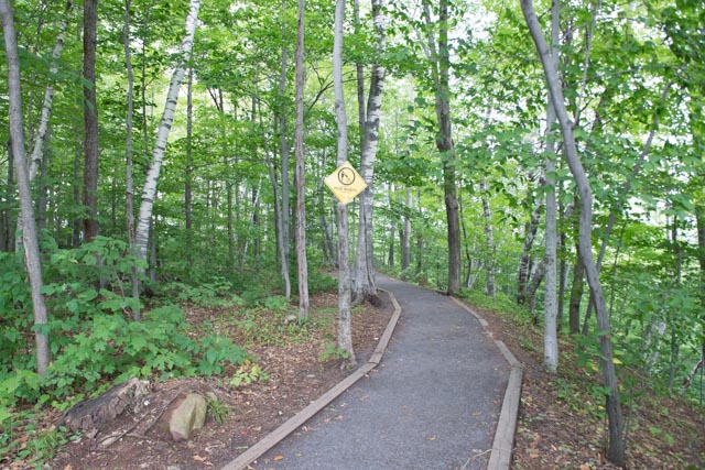
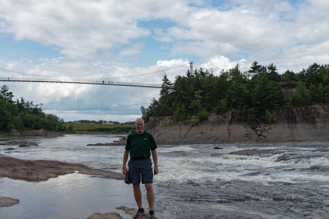
We did a loop hike, mainly to see the suspension bridge. It rained a little when we crossed the river on the bridge, then the sun came out. The wind blew the clouds away!
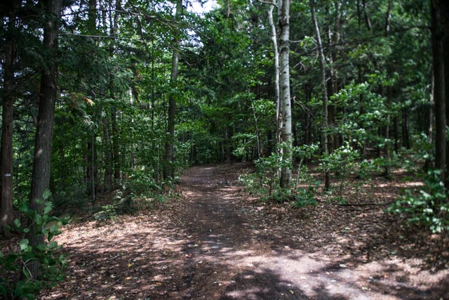
Of course, we had to get down to the river so we found this trail.
The suspension bridge from the riverbank…

Some views of the waterfalls created by the hydroelectric dam…
The power plant was under renovation and out of service, but here were viewing windows to look down to the turbines.

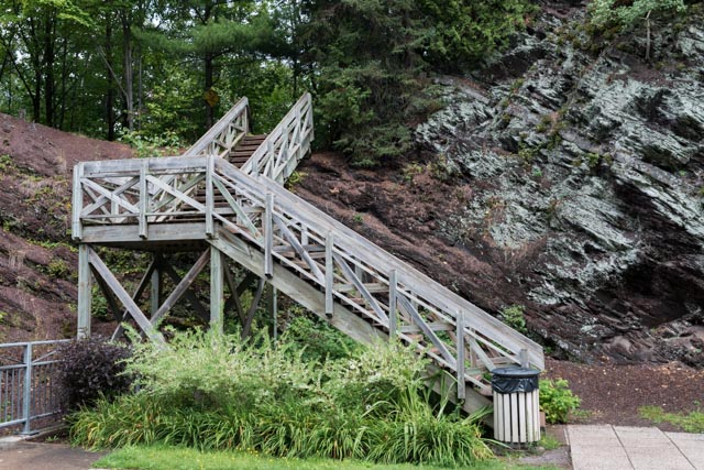
This is the walkway back up the hill on the way out.
We did see some pretty unusual rock formations in the riverbed. The rock was flaking, the gravel you see behind this staircase is really composed of quarter-sized flakes of rock!
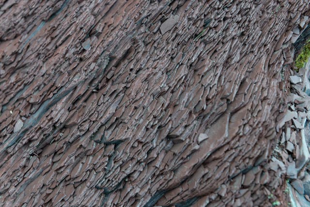
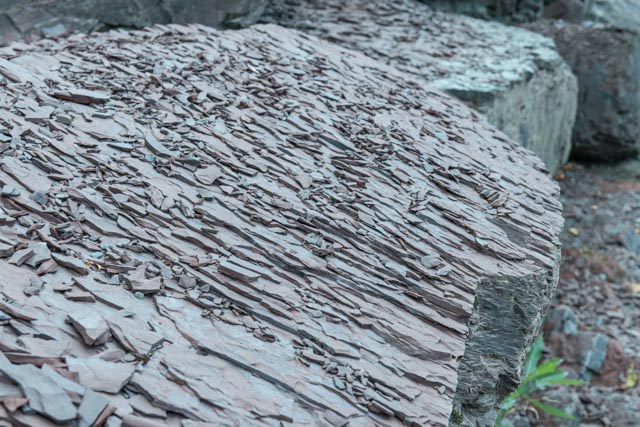
In the riverbed, there are slabs of a granite-like material coming up at an angle between the darker, flaking rock.

After leaving the park, we drove into Vieux-levis (Old Levis) and got our first look at the walled city of Old Quebec, across the river. We will be taking the ferry across tomorrow morning and spending the day there.
