After leaving Green Cables, we headed east for lunch at the famous Dalvay-By-The-Sea Resort. The house was built in 1895 by Alexander MacDonald, a wealthy businessman and one-time president of Standard Oil Company with John D. Rockefeller. He named the house “Dalvay By The Sea” after his boyhood home in Scotland. The lower half of the house was built with Island Sandstone in its natural boulder form and the huge fireplaces were also constructed with quarried blocks of the famous reddish sandstone.
Road to Avonlea fans and fans of the Anne of Green Gables movies will be most familiar with Dalvay featured as the “White Sands Hotel.”
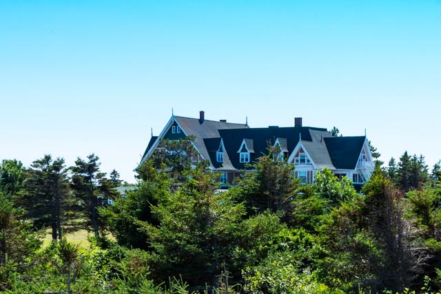
It had a very neat, simple interior, almost “homey”. Sorry, no pictures of lunch and no, we did not stay for the “afternoon tea”. Food was fantastic as expected.


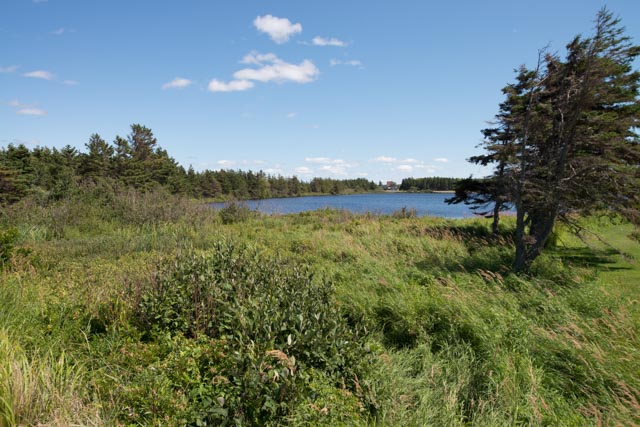
We took a short walk down the beach, passing by these wetlands:
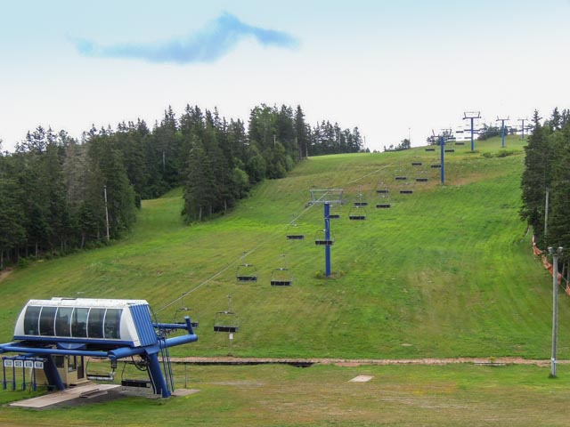
In the afternoon, we drove over to the Brookvale Provincial Ski Park, where I would be running a trail race the next day. It was beginning to cloud up and by morning, it was raining. Brookvale has downhill, cross-country, ski biathlon, and mountain bike courses, with the shooting bowl directly below the start line. We knew it was going to be steep . . . .

Waiting for the start, we got soaked as the rain really opened up and the thunderstorm came in. The course became very muddy, with actual whitewater running town the trail in several instances. We had an uphill start to the right and downhill finish at the left. By the time we returned to this point, the downhill was all slippery mud . . .

The course was very steep and rocky in parts as were spent a lot of time on the off-road bike courses. When we did hit the grassy areas, they were usually under several inches of running water. Because of the thunderstorms (with lightning, very close lightning), it was sometimes very dark in the thick forest, making it very hard to see the pink tape marking the course.

I had to turn back several time because I had missed a turn or two. I actually ran about 5K without seeing another runner, I could not keep up with the first grouping and absolutely did not want to be in the second (last) grouping so I ran in the middle, between them. This is a nice, steep downhill section with running water . . those are puddles/ponds on the single track a little further down. I think I may have seen a kayaker somewhere in there . .

And, of course, I did a face plant, tripping over a submerged rock but the heavy rain managed to rinse me off before the finish.
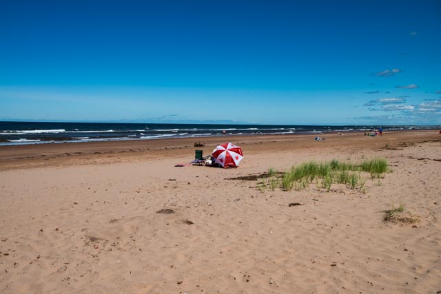
The next morning, to relax, we travelled to the most easterly point on the island, appropriately named “East Point”, which is considered the finest white sand beach on the island. We found this attraction on the way down to the beach:
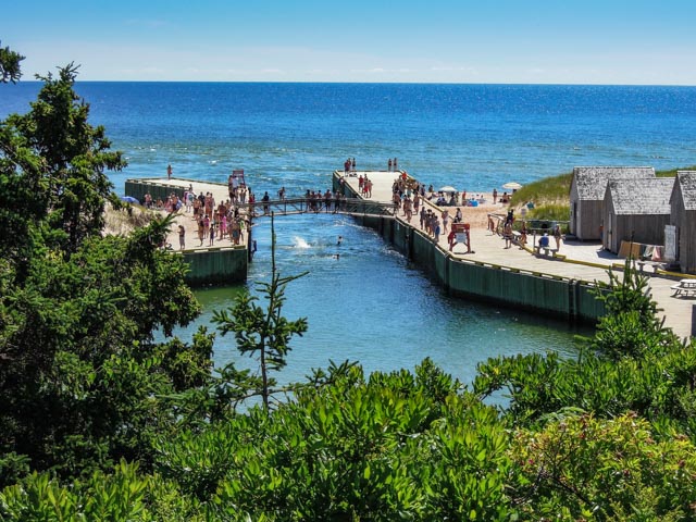
With all of the appropriate warning signs:
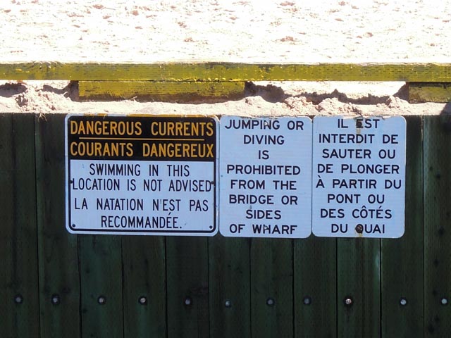
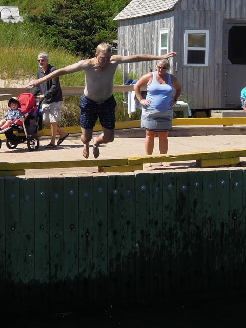
Apparently, jumping in was allowed so, what the heck . . it was only about a ten foot down to the water and I can’t read French, so I dove in:
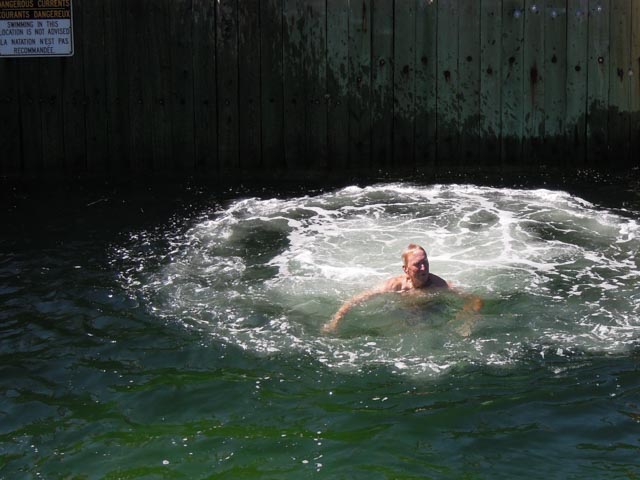
Once you were in the chute, if you did not grab onto one of the ladders, you were swept out to sea with the current:

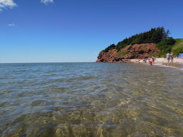
It was a little difficult swimming back to shore, but not really bad. The water was clear and semi-warm, and you had to keep an eye out for the jellyfish. This is a view looking down the beach:
After we finished here (when it warmed up and got crowded), we moved on to complete the Points East Coastal Drive.
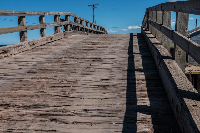
This is a “Baily Bridge”, a British designed, prefabricated truss type bridge used in WWII. The design was used extensively by both the British and American forces as it could be trucked into position and built by had, without heavy equipment. It was built to support a tank. WWII era tanks were much lighter, and that was 75 years ago. Yes, we drove across it.
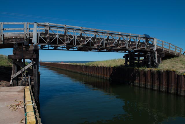
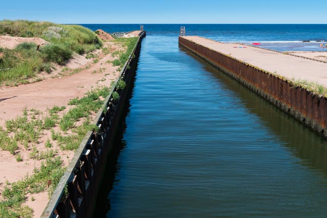
The waterway under the bridge. The lobster boats in the harbor will fit through here, barely . . .
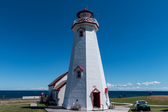
The lighthouse at East Point. That is a Chevy Volt to the right, getting a free charge.
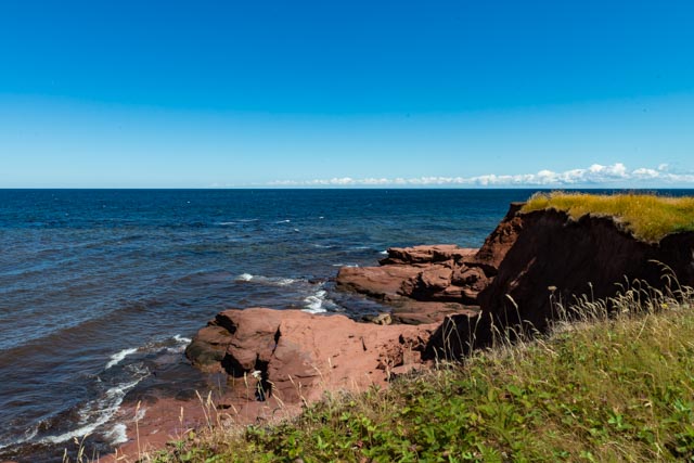
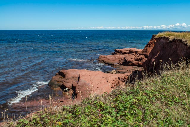
I took a couple of cliff shots here. There were several seals in the water below us but I did not attempt to photograph them. We just watched’em.
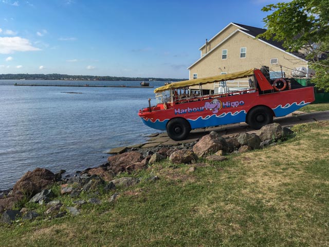
Well another day of resting so I left early in the morning for a run on the Confederation Trail. I started near the Charlottetown airport and followed the trail, by the PEI University and into downtown. I got to see the morning launching of the Harbour Hippo:

Crossing into the Historic district, downtown, near Holland College:

The Trinity Church, founded in 1778 by Benjamin Chappell, a friend of John Wesley.

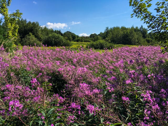
Some of the scenery along the trail:

I did not encounter a lot of people on the way into town, but the activity picked up a little getting back to the airport . . about a 10+ mile route.
We will be heading to Nova Scotia in the morning. We have to pick up our numbers for the “Not Since Moses ” run at low tide in the Bay of Fundy, Saturday morning. It is supposed to be a -50 foot tide . . .
