With the dawn of another nice day in Sedona, we decided to take a couple of walks. We drove into Sedona, turned onto Dry Creek Road/Forest Road 152, which was a true 4×4 road. (I tried to make it in 2WD, but just spun my tires.) We passed many Jeeps and other 4×4 vehicles parked at the rougher parts with their occupants choosing to hike the distance. We crawled past the Devils Bridge Trailhead (the destination of most, if not all of the hikers) and past the Brins Mesa Trailhead to the end of the road. The only other vehicles at this point were Forest Service vehicles and one Jeep from New Mexico. I now have red mud to go along with the dust, gravel and grime on the truck. The Forest Service personnel set up a base camp and began working on trail repairs. We started up the canyon on a well-marked trail . . destination Vultee Arch, a natural arch named after Gerald and Sylvia Vultee who crashed their plane and died nearby in 1938.

We followed a small stream most of the way up the canyon, crossing it numerous times. This creek is seasonal but due to the recent rains/snow, was flowing at a pretty good clip.
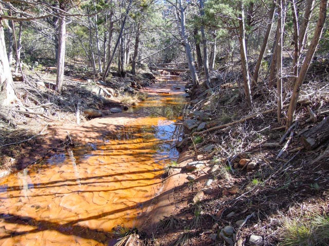
Looking back down the “trail” from where we started:
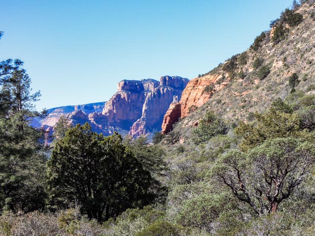
After 4.5 miles of very rough 4×4 roads and 1.6 miles of mostly uphill hiking we reached our destination:

We were warned that the arch is unstable so Cathy decided to prop it up so I could pose near it:


Wer met a couple from Quebec at the arch. They had hiked in via Sterling Pass, a 4 mile treck from the main road. We started back down the trail shortly after spending a few minutes on a very flat rock below the arch. The temperatures had warmed somewhat and the trails were very wet and muddy in shaded areas on the return trip.

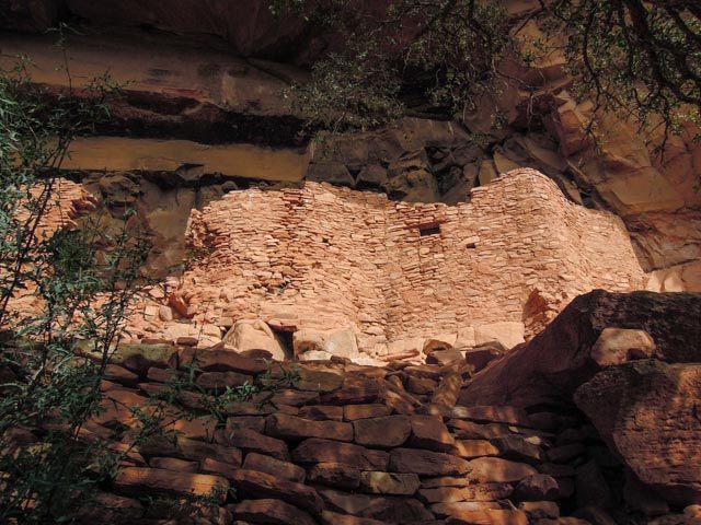
We still had daylight left so we went the Hohaki Heritage Site which as cliff dwellings and rock art. This sight was at the end of a 4.5 mile dirt and rock road and is frequented by the “Pink Jeep” tour company. We parked with some Pink Jeeps and other ATVs and walked into the ruins. In this case, we could get right near the actual ruins but were cautioned not to climb on them, get in them, or touch them as all of that will cause further erosion. These ruins have not been reconstructed are completely original. They were built by the Sinagua and because they were built under a natural overhanging rock cliff, they were not affected by weather. Sinagua occupied the entire region beginning 650 AD. These ruins date from 1100 AD to about 1300 AD. These ruins vary somewhat in design from what we saw at Montezumas’ Castle, Montezuma’s Well and Tuzigoot but were all built by the same group, which numbered about 10,000 individuals in all.
This is a photo of the main structure as seen from the lower trail. The upper trail, that gets “up close and personal” is quite a climb/scramble up some rock stairs and loose rocks.
This is the trail returning from the top of the ruins

Saw this little guy next to the trail on the return (a just emerging cactus). In another day, we might have taken this one home. In another day . . .

We returned to our camp at Camp Verdi and decided to take part in the Prime Rib dinner special at the Cliff Castle Casino which is across the highway from us.
