Problem: How do you get large motor homes and trailers through a tunnel that is only 11′ on the sides and 13’6″ in the center? You close the tunnel temporarily to allow the “oversize” vehicle to travel down the center of the road . . .
We saw a neat trailhead at the end of this tunnel yesterday so we decided to come back and take the trail to an overlook of Zion Valley. Along the way, we were directly above multiple slot canyons, hundreds of feet deep.
This was an interesting “beehive” formation along the trail:

Once we got to the top, the view was spectacular. The valley below leads you into Zion Canyon. That is the road leading to the tunnel entrance winding up the canyon.

Here we are at the overlook. We are directly above the very large arch-in-making that we saw yesterday. That is the valley hundreds of feet directly behind us.

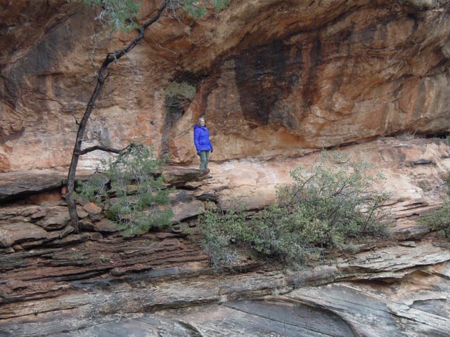
I had to climb a little higher to get a better view?

This is my sister Barbara on her way down from the overlook. The trail was very narrow in places with shear drop offs:

This is Cathy hugging the wall as the trail actually slopes downhill into a canyon. She is getting used to these trails.

Here is an example of a suspended walkway over a very deep canyon.

And the slot canyon below the suspended walkway:

Another precarious part of the trail. This part has the trail directly on top of the large smooth dark rock in the center of the frame:

Here is Cathy on the trail. You can see the top of the black rock below her. Again, a slip here can lead to a pretty big fall . . .
I met this person on the trail. She was walking with her family and comes here often. Her great-great-great grandfather, Isaac Behunin, was the first settler in Zion in 1868. He had a log cabin near where Zion Lodge now stands. Mormon settlers left their mark, giving Zion the name that would eventually stick. Mormons awed by the immense beauty of the canyon referred to it as “Zion” since its magnificence reminded them of a heavenly city described in the Little Zion – Old Testament. Isaac Behunin said: “These great mountains are natural temples of God”.
Again, you meet interesting people on the trail.

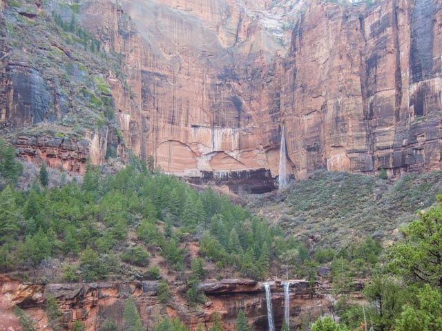
After the overlook trail we decided to hike to the base of these waterfalls. It took us about 2.5 hours to make the trek, reaching the base of both the upper falls and the twin lower falls. The trail was very muddy due to the recent rains, with the mud being over two inches deep much of the distance. (We quickly gave up trying to keep clean and wound up taking our shoes to the showers when we got back to camp).
As we started up the trail, we took a look back at this view of the Virgin River below. We did watch three mule deer cross the river and disappear into the woods.

Cathy between a rock and a hard place. Left to the base of the twin lower falls and right to the base of the upper falls . . .

This is the edge of the lower falls, with the valley down below. The rock here was very slippery so I did not get too close to the edge . . .
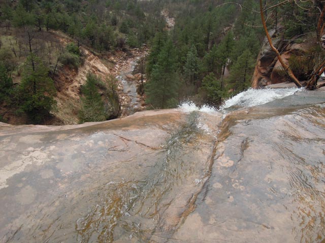
This is the area where I crossed over the stream to get the pictures of the upper falls. A slip here could lead to a trip into rapids leading to the twin lower falls below.

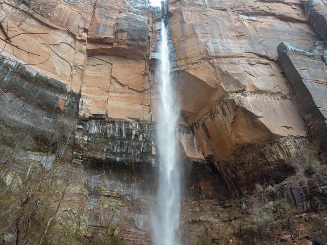
This is the upper falls and the pool that has formed.


I know Steve is “up” for anything, but Kudos to Cathy and Barbara for doing that! It looks scary and awesome at the same time!
LikeLike