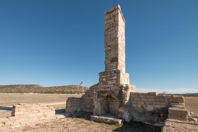
Fort Lancaster, TX
Fort Lancaster is about 40 miles off the beaten path. We pulled in to the parking area and were the only visitors there. The park employees offered us a golf cart to visit the ruins… do we look that old? This site receives about 3,000 visitors a year and there were three employees at the visiter center!
This is the camp graveyard. The camp was founded in 1855 to protect westbound settlers, protect the water source on the Pecos river, and is located on the original Butterfield stage route. At the onset of the Civil War, the commander handed the control of this facility over to the Confederates. At the end of hostilities, it was returned to US Government occupation and soldiers of the 9th Cavalry, also know as the “Buffalo Soldier”, rotated through the facility. In December of 1867, this fort was attacked by a larger force of Kickapoo and Lipan Apache raiders. The soldiers stationed here successfully defended the fort and defeated the raiders, distinguishing Fort Lancaster as the only Texas military fort that suffered a direct attack by Native Americans. The fort was abandoned in 1874 and the federal troops interred here were moved to other federal cemeteries. This is the marker for the only Confederate to be buried here and he remained, along with numerous unmarked graves of civilians.

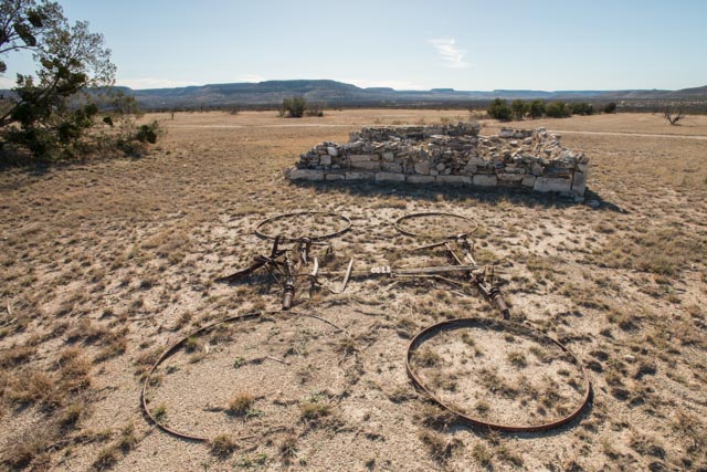
The ruins in the background are that of the Sutler Store. Evidently the wagon in the foreground was late for that final delivery…
Because of the dry Arizona conditions, this wood header has survived over 160 years. This is a doorway leading into Company K Enlisted Men’s barracks. These barracks could house 30 men.

The next two photos are additional views of the Company K Enlisted Men’s barracks.

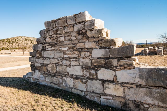
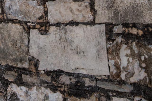
This is an outside wall of Company H Enlisted Men’s barracks. I noticed one limestone block in this wall was carved with information about the man who worked on the wall. I talked with the docent on site and they did not notice the carving but told me that they don’t have good records concerning the enlisted men.
Here is a close up of the carving:
This is the view from near the visiter’s center.

Fort Bowie. AZ
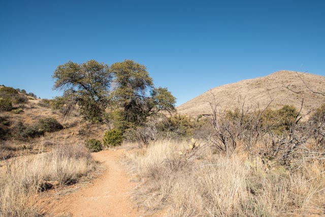
Fort Bowie was established at the end of the Mexican Wars (ca. 1848) to protect Apache Pass, the route of the Butterfield Stage line; Apache Springs, the sole source of water for fifty miles eastbound and westbound; and to protect settlers travelling through to the goldfields of California. It also was instrumental in the Apache Wars (ca 1862-1886). Both Geronimo and Cochise had “visited” this outpost. The trailhead for this post was at the end of a 13 mile gravel road. Once we disconnected and turned the motor home around and reconnected, we took off on the three-mile trail to the ruins. (We are continuing to improve our speed on the disconnect/connect processes).
The trail immediately crossed a wash with running water and then traced up a dry wash, across dry, cactus laden rolling hills, up a rock strewn canyon and finally to the first ruins.

This is the Butterfield Stage Stop (what’s left of it anyway…)

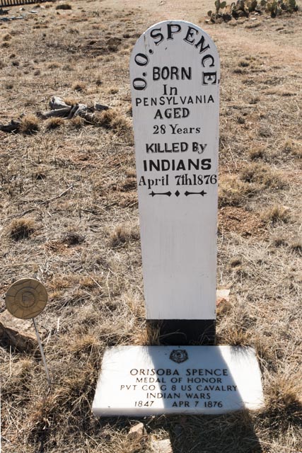
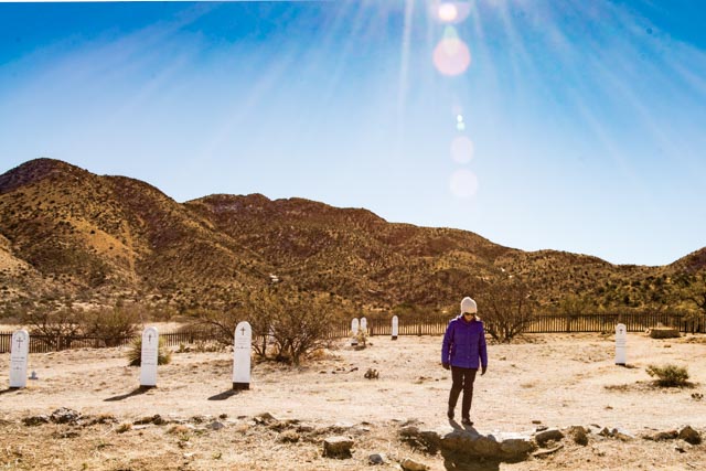
Next we made it up to the cemetery. We found the grave of a Medal of Honor recipient:
Cathy looking at headstones. The graveyard was originally surrounded by adobe walls to prevent damage to the graves by range cattle, but the adobe washed away over time and has been replaced by the wood picket fence. The soldiers were moved to federal cemeteries in San Francisco when this fort was abandoned. Caught some neat lens flare on this shot.
We continued up a small ravine to the site of Apache Springs. The water flow has been steady here for more than a hundred years.

We finally made it to the site of the fort. It sits in a saddle right on Apache Pass. Some of the original adobe walls have received a coat of plaster to prevent further deterioration.

After spending about an hour at the ruins we climbed several hundred feet to a ridgeline taking a different trail back to the trailhead. This was a shorter but much steeper route, with a half mile of switchbacks descending into the valley below.
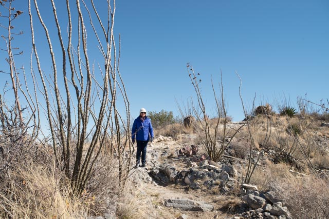
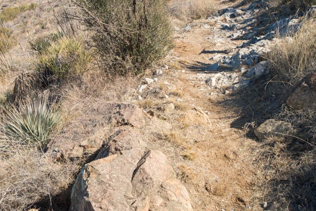
We crossed an interesting geological phenomena. If you look closely at the trail, you will see darker rock (igneous granite) in the foreground and lighter rock (sedimentary limestone) in the background This is a fault where the igneous is slowly being pushed up and over the existing limestone. The plant life differs at this fault line as some plants (yucca and ocotillo) prefer the sedimentary limestone-based gravel/soils and some (beargrass) prefer the igneous granite-based gravel/soils. In 1873 geologist G.K. Gilbert discovered and documented this fault line, known as the Apache Fault. This water-bearing fault is also the source of the water seepage at Apache Springs. Hopefully you can make out the different color of rock and the transformation in plant life:
Continuing down the trail we were awarded a spectacular view of Siphon Canyon, route of the Butterfield Stage line and site of the Bascom affair, a battle between Cochise, the leader of the Apaches and Lt. George Bascom and his troops (a story for another day). Further off in the distance you can see the San Simon Valley used by the Spaniards on their explorations in 1695 and finally, the snow-covered Peloncillo mountain range, about 35 miles in the distance. Beyond the Peloncillos is the New Mexico border.

This hike took about three hours and after reaching the motor home we had lunch, then once we reached pavement, we stopped at took this final photo:

Both the motor home and the truck are filthy and covered in dust. Oh well, maybe it will rain.

Great report . I hope y’all enjoy your trip. Be safe .
LikeLike