We spent a day and a half at the Gettysburg National Military Park in Pennsylvania. Our first stop was the park visitor center. We talked with the park ranger and came up with a game plan to maximize our ability to enjoy the park
Day 1 The Film and Cyclorama
The introductory movie was very informative and professionally done. Morgan Freeman did the narration. We went from the theater directly to the Cyclorama of the Battle of Gettysburg. The painting here is 42 feet tall by 377 feet wide, the largest in the United States. The center was closing when we finished the Cyclorama so we headed back to our campsite for the evening. We planned to be at the park again first thing in the morning to continue with the auto tour and museum.
Day 2 The Self-Guided Auto Tour
We arrived just before 0700 at the park to drive the self guided tour after purchasing the 3 CD tour guide and descriptive book / maps the day before. This was supposed to be a 2 1/2 to 3 hour tour. Six+ hours later (we spent a lot of time walking the battlefields and viewing some of the 1,400 monuments) we finished and headed for the museum.
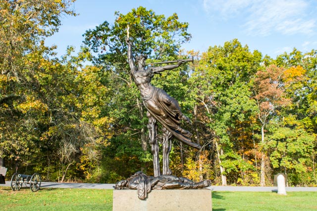
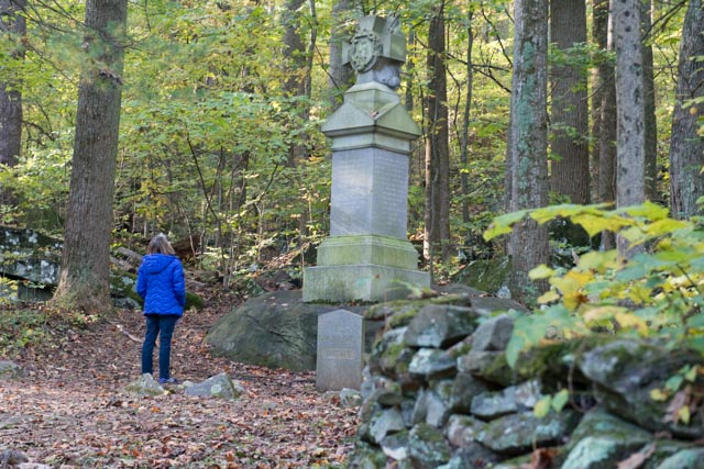
This is the Eternal Light Peace Memorial, positioned at the north end of the battlefield.

Guns positioned along the Confederate line on Seminary Ridge. The Union line was positioned directly across the fields. Both lines were several miles long.


North Carolina memorial, designed by Gutzon Borglum. Borglum also designed Mt. Rushmore and the Stone Mountain (Ga) confederate sculpture. This memorial is located on Seminary Ridge, the Confederate battle line.

With the fog lifting, time to line up a good shot at that farm in the distance!

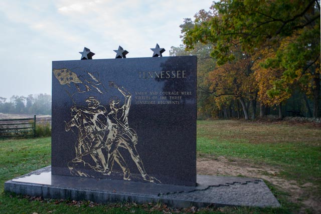
The Tennessee Memorial on Seminary Ridge
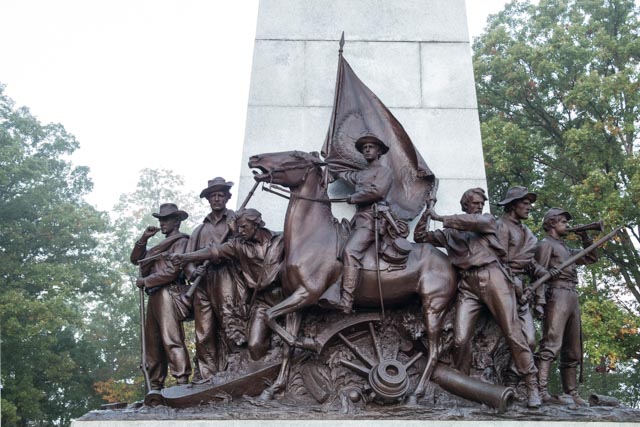
The top of the Virginia Memorial on Seminary Ridge

The base of the Virginia Memorial . . . The large open field across from this memorial is where the last Confederate assault known as “Pickett’s Charge” occurred on July 3rd.
The Louisiana Memorial
The Alabama Memorial

Cathy looking at the Massachusetts Memorial near Round Top.
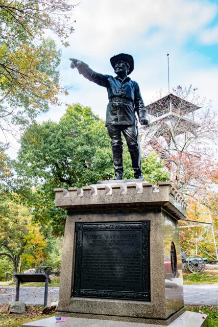
Brig. Gen. Gouverneur Warren Memorial
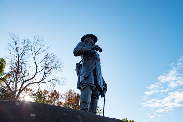
Riding to Little Round Top, Chief Engineer Warren, Meade’s chief engineer, was horrified to see that only a few Union signal troops were occupying this crucial high ground, with masses of Confederates approaching. He ordered reinforcements to immediately secure the hill. This action saved the battle helped greatly in the defeat of the Confederate forces at Gettysburg.
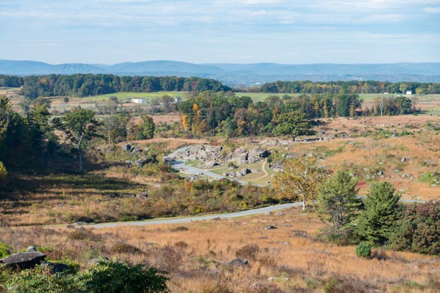
At the base of the hill, there is a wide flat stretch, directly to the right of the outcropping, that leads to a treeline several hundred feet beyond. This area was referred to as the Killing Field, and for good reason. Sharpshooters had easy pick’ens on anyone that entered the area. About a block away is the “Wheat Field”, a 10 acre parcel that changed hands several times within 24 hours at a cost of about 4,000 casualties. All in all, a particularly gruesome area.
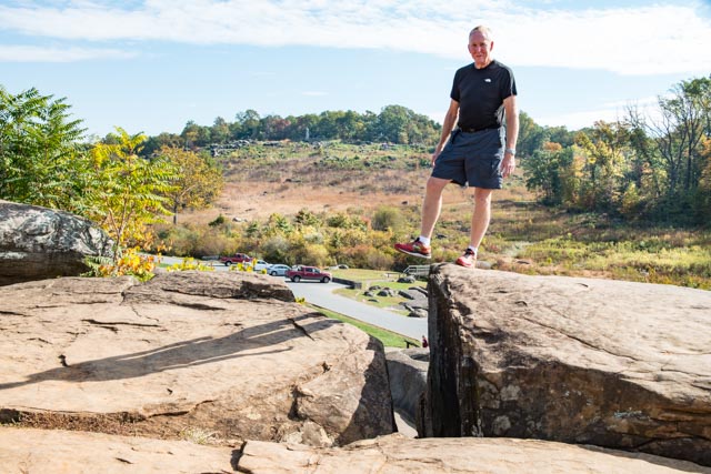
The Devil’s Den as seen from the Warren statue. This rock outcropping was held by Union forces, taken over by the Confederates and taken back by the Union soldiers with great loss of life. Many of the most gruesome photos in the battle were taken here, mostly bodies strewn amongst the rocks. As you can see, there were many places to shelter from shellfire. Where I am standing, it is about 500 yards to the top of Little Round Top. The gaps between the rocks are numerous and about 30 feet in-depth, providing perfect shelter/hiding/sniper placements. Union sharpshooters had a range of about 1,000 yards and Confederate sharpshooters only had about 500 yards because of their inferior rifles. The casualty rate for Confederate troops was well in excess of 50 percent in this area, mostly Alabama troops.


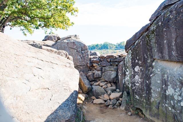
This is the iconic Alexander Gardner photograph of a dead Confederate soldier behind a rock barricade in Devil’s Den, at the base of Little Round Top. No, I did not take it but, now for the rest of the story . . .
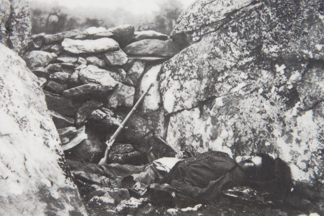
We visited the actual site of the photo and discovered the entire incident was staged. The soldier was hit in the field, 40 yards behind the barricade and the photographer, to make a more poignant – and marketable shot, placed the body on a blanket and drug it to the wall. He positioned the body and rifle for maximum effect. I guess this type of crap has been going on forever . . anything to make a buck.
This is the “Copse of Trees”. During the battle, there were 7,000 Union troops posted around this group of trees. This represents the “high-water mark”, where Pickett’s 12,000 Confederate troops were repelled (Pickett’s Charge). This was the climatic moment of the battle, the beginning of Lee’s retreat.

Just an experiment with shooting directly into the sunlight . . .

This is the Spangler Spring, at the base of Culp’s Hill. This was the main water source for the Confederates during the battle. The water flow was minimal…Confederates took control of the hill when the Union troops were in battle at Little Round Top. They were driven off in a seven hour battle when the Union troops returned.

We took a couple of shots of the surrounding area, including one of the town of Gettysburg.
To get these shots, we climbed the viewing platform directly behind the statue. There were 94 steps to the top of this circa 1880 platform. There were several of these viewing platforms in the park but because of our early start, it was too foggy to see anything on the first two. I think he was saying there were more platforms over there!
Day 2 The Museum
The museum was supposed to take about 1 1/2 hours to go through. We arrived at about 1400 and finished when it closed three hours later. Maybe we are getting slow, but we probably did not see everything . .
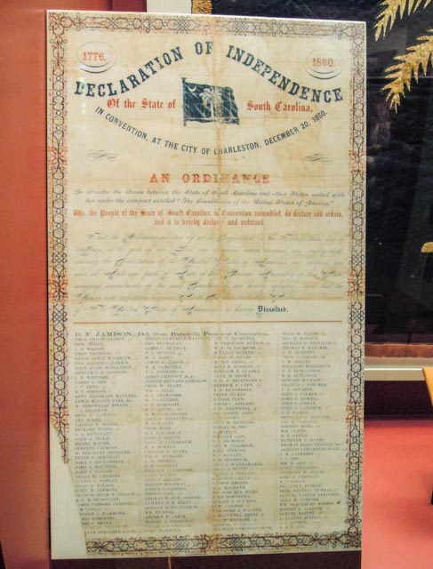
This is the original Declaration of Independence for South Carolina, the first state to succeed from the Union.
I had to put this in as it seems history repeats itself and some things never change. I just photographed the verbiage directly from a couple of the exhibits to avoid having to take notes:
Day 2 Beyond the park
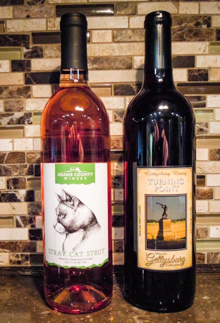
As our activities within the park came to a close (it closed at 1700 – we had to leave!), we had to pick up a couple of local souvenirs. We stopped at the Adams County Winery where Cathy tried the “Stray Cat Strut” a blush with strong grapefruit tones, and decided to purchase a bottle. Not to be outdone, I picked out a bottle of a dry Cabernet / Merlot blend. Both were produced locally. I don’t anticipate we will make it home with the bottles intact.
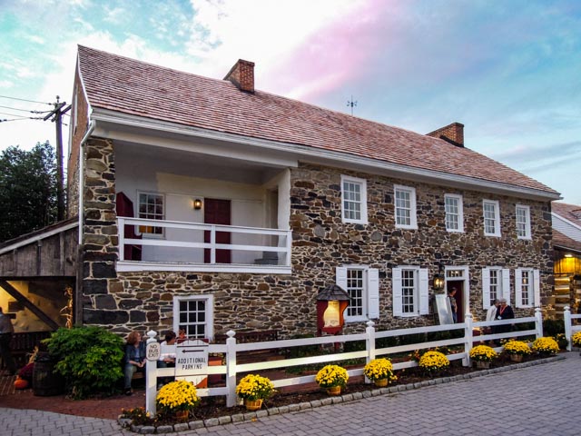
We had dinner at the Dobbin House, the oldest building in Gettysburg. It was built for Reverend Alexander Dobbins, his wife and 19 children in 1776 and was home to the Reverend’s Classical School, the first of its kind west of the Susquehanna River. This house is believed to be the first station in the Underground Railway north of the Mason-Dixon line and the Slaves Hideaway is still intact upstairs.
During the Battle of Gettysburg, it was a field hospital servicing both Union and Confederate casualties and was within range of the guns from both sides and was frequently struck by shellfire. Interior lighting was all by candlelight and the staff wore colonial period outfits. It was recommended to us by locals and the setting, the food and the service were superb.