We left Tok about 1100 for the 140 mile drive to Glennallen, using the Glenn Highway Tok Cutoff, expecting a 2.5 hour trip. We did stop when we had access to the Alaska Pipeline. This pipe carries crude oil from the North Slope to Valdez. Very interesting in that it is elevated to prevent the heated oil from affecting the permafrost. Cathy and my sister, Myrna and me.
On the way, we were listening to an audiobook (The Battle of Gettysburg) and during the reading of the Gettysburg Address, a bald eagle flew in front of us, rode the air cushion created by our motor home, staying about 50 feet in front of the windshield for about a quarter-mile, then veered off and landed in a tree top. It was kinda neat timing . . .
Travelling the Edgerton Highway, we encountered two bears on the trip to McCarthy, in the Wrangell-St. Elias National Park. This park is six times larger than Yellowstone and is the largest National Park in the system. The distance from our camp to McCarthy was 126 miles and we were told that it takes about two hours. FOUR hours later, we arrived. Road was partially paved, partially chip seal, mostly frost heaves, mud and pot holes. Big pot holes. Because we started early, we encountered two bears on the way. This guy (a cinnamon black bear, not to be called a brown bear) was within 20 feet of us and about 15 minutes later we saw a black, black bear. The black bear got deep into the woods before we could snap a picture. These guys can be pretty quick.
Cathy and my two sisters crossing the footbridge, across the Kennicott River leading into McCarthy. This river is being fed by the Kennicott and Root glaciers.
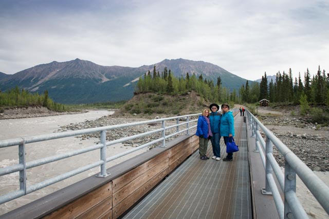
The town of McCarthy is a historic copper mining town, which provided essential services for the Kennecott copper mine, 5 miles upstream and has 37 full-time residents.
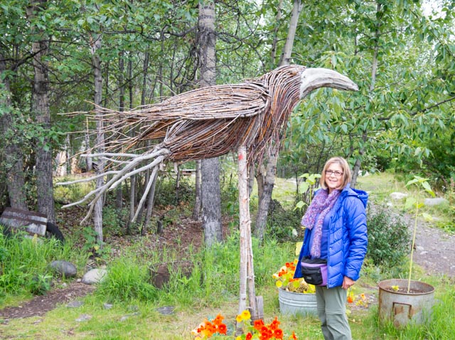
Cathy likes the big birds . . .
Several views of the historic Kennecott copper mine.
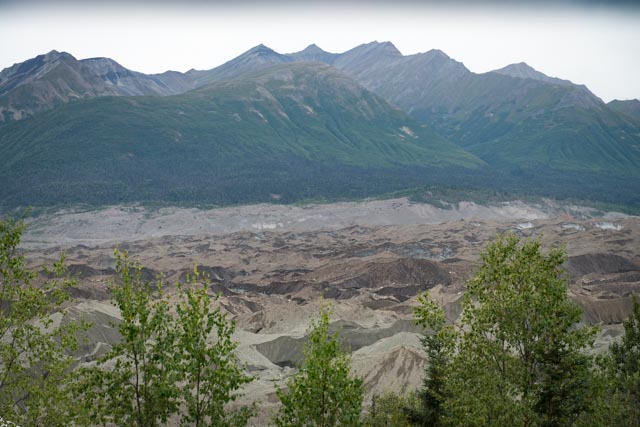
While touring the mine, we were amazed at the size and depth of the ice fields at the foot of the confluence of the Kennicott and Root glaciers. The area between the trees in the foreground and the mountains is solid ice. It is hundreds of feet deep, covered in gravel and extremely deceiving / dangerous. There are lakes and rivers under this field and potential for cave ins are omnipresent. The white material is from the Root glacier and the brown and grey material is from the Kennicott glacier. These two icefields end in a small lake where the ice calves and creates icebergs.
We were too late to take a guided glacier tour / walk but since the “Hills were calling” (a quote from John Muir), Cathy and I obtained a map from the National Park Service, told them where we were head, listened to their bear warnings, then set out on our own to get to the Root Glacier. It was about a two-mile trek to the glacier viewpoint. This glacier is about 27 miles long and has a 7,000 foot vertical icefall (larger and more dangerous than the famous Khumbu Icefall at basecamp, Mt. Everest) about 13 miles upstream that has never been successfully scaled. Tempting. . . This icefall is so large it looks like a jumbled ice mountain from the footbridge entering McCarthy, seven miles downstream.. We decided to take a path down to the toe of the actual “white ice” of the glacier. The trail was very steep, almost vertical in places, single track, gravelly, slippery and rocky with many hundreds of feet in drop offs to the icefield below, pretty knarley to say the least.
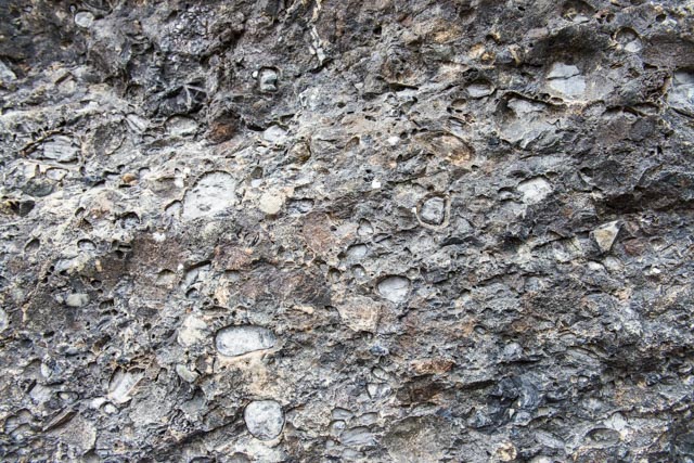
Saw this boulder on the viewpoint trail and thought it had a pretty neat surface. It looked like it picked up a lot of loose stones at some point . . .
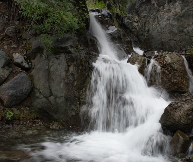
Unnamed waterfall and cascade from some ice fields directly above us . . .
Serious bear area. We were warned of very recent bear activity by the NPS. They provided secure storage facilities for backpackers to store their food when camped along the trail to the viewpoint. We passed three of these and saw recent evidence of bear and moose. We are getting pretty good at identifying the “evidence” at this point.

Cathy about 1,000 feet onto the Root Glacier. At this point the ice was probably 500 feet thick and about 1/2 mile wide by 27 miles long. There were many crevices where the ice was a deep blue, and you could hear the water running deep beneath us (look behind her). Cathy found some ice cubes and got to taste million year old ice. We thought that was pretty cool . . .(literally)

It rained all the way in and all the way out but the temperature never changed until we entered the ice fields.
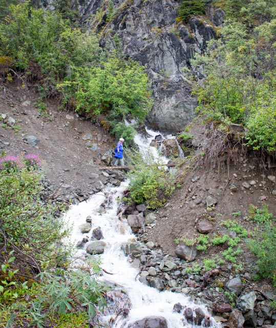
Check her out! “Glacier Alum” Cathy on a single track, wet wooded rail, crossing a rushing stream which cascades directly in to a very deep ice walled canyon. She did it like a trooper. A slip here could be ugly.
After we hiked back to our truck, at about 1930 (in the rain) we discovered we had a flat tire. We had to change the tire in the mud and rain then make the 4+ hour trip back up (the now) rain-soaked pot hole road to camp. We pulled into camp at 2330, making for a very long day. Was up and out at 0700 this morning to get mire tire repaired, but will be unable to make the trip to Valdez because of the incident. Oh well, maybe next time . . .
We did see this big fella on the way out. Too busy eating the brush to be bothered with us. (It was pretty dark by this time so this was shot at ISO 1600 for any photography buffs)
Next stop: Delta Junction / North Pole / Fairbanks.
